Geotechnical Drilling for Mine Infrastructure: Reducing Risk in African Roads, Plant Pads and Tailings Facilities
A new plant pad is constructed at a remote mining site. Initial surveys show acceptable bearing capacity. Months later, after heavy seasonal rainfall, differential settlement appears. Cracking develops in slab sections. Drainage begins to pool. Remedial engineering follows.
The cost of fixing inadequate ground investigation is always higher than the cost of doing it correctly at the start.
Across African mining operations, geotechnical uncertainty is one of the most underestimated risks to infrastructure performance. Roads, plant pads, tailings facilities, and expansion zones depend on accurate subsurface data. Without structured geotechnical drilling programs, design decisions are often made on incomplete assumptions.
Geotechnical drilling is not a compliance formality. It is capital protection.
Why Geotechnical Investigation Is Critical in African Mining
African mining environments present highly variable subsurface conditions.
Soil Variability Across Short Distances
In many regions, soil composition can change significantly within tens of meters. Expansive clays, collapsible sands, weathered rock profiles, and residual soils may exist within the same footprint.
Without systematic investigation, infrastructure is designed for average conditions rather than worst-case zones.
Seasonal Rainfall and Moisture Cycles
Dry-season drilling can mask moisture-sensitive soil behavior. When heavy rains arrive:
- Expansive clays swell
- Bearing capacity reduces
- Slope stability changes
- Drainage patterns shift
Infrastructure designed without accounting for these cycles becomes vulnerable.
Water Table Fluctuation
Fluctuating groundwater levels influence:
- Pore pressure
- Effective stress
- Shear strength
- Tailings stability
Monitoring and characterization must account for seasonal variation rather than a single snapshot in time.
Expansion and Closure Planning
Mine infrastructure is rarely static. Plant expansions, road realignments, and tailings lifts require adaptable design frameworks.
Geotechnical drilling provides baseline data that supports lifecycle planning rather than one-phase construction decisions.
What Geotechnical Drilling Actually Delivers
Geotechnical drilling programs provide measurable inputs that inform engineering decisions.
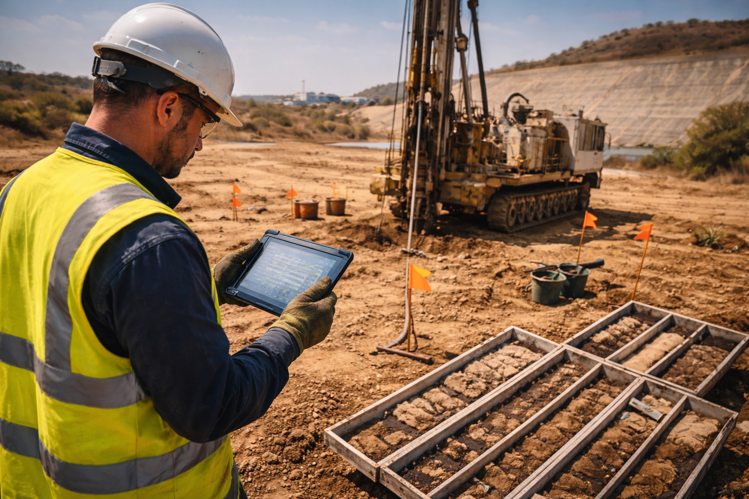
Borehole Logging and Core Sampling
Drilled boreholes allow:
- Visual soil and rock classification
- Core recovery assessment
- Stratigraphy mapping
- Structural interpretation
Accurate logging prevents oversimplified subsurface assumptions.
Cone Penetration Testing Parameters
CPT investigations provide quantitative data including:
- Cone resistance (qc)
- Sleeve friction (fs)
- Pore pressure (u)
- Inclination
These measurements support estimation of:
- Undrained shear strength
- Relative density
- Liquefaction potential
- Settlement risk
Data-driven characterization reduces uncertainty margins in foundation design.
Foundation Design Inputs
Geotechnical data informs:
- Bearing capacity calculations
- Settlement predictions
- Slope stability modelling
- Drainage design
- Ground improvement requirements
When these inputs are reliable, structural engineers design with confidence rather than contingency padding.
Tailings Facilities and Risk Governance
Tailings facilities require disciplined geotechnical understanding.
Stability and Shear Strength
Undrained shear strength directly affects:
- Embankment stability
- Liquefaction susceptibility
- Failure risk during extreme rainfall
Measured data reduces reliance on theoretical assumptions.
Drainage and Consolidation Behavior
Pore pressure monitoring and soil permeability assessment support:
- Drainage system design
- Consolidation modelling
- Long-term settlement projections
Without accurate data, stability calculations become speculative.
Design Accountability
Tailings governance expectations have increased significantly across global mining markets. Demonstrating structured investigation methodology and documented data trails strengthens operational credibility.
Subsurface accuracy depends directly on properly configured geotechnical drill rigs capable of maintaining borehole stability, sampling integrity, and CPT consistency under African site conditions.
Equipment suitability directly influences data quality.
Field Log Example: Infrastructure Risk Identified Before Construction
Site Type
Proposed plant expansion pad at a remote Southern African mine.
Investigation Scope
- Boreholes at 25-meter grid spacing
- CPT testing to 20 meters depth
- Moisture content sampling
Soil Conditions Identified
- Upper 3 meters: compacted fill
- 3–8 meters: expansive clay
- 8+ meters: weathered rock
Unexpected Findings
Localized zone of highly plastic clay with elevated moisture content in one quadrant of the proposed pad footprint.
Design Adjustment
- Revised foundation depth
- Localized ground improvement
- Enhanced drainage installation
Risk Avoided
Prevented differential settlement in critical load-bearing section.
Estimated Capital Protected
Avoided structural remediation costs, downtime, and rework delays during construction phase.
Documented Field Log entries convert geotechnical investigation from theoretical planning into defensible engineering practice.
Practical Checklist for Mine Engineers
Structured geotechnical investigation requires discipline.
Pre-Investigation Planning
- Define infrastructure load profiles
- Establish investigation grid spacing
- Identify seasonal timing considerations
Borehole Execution
- Confirm borehole depth targets
- Maintain sampling integrity
- Document recovery rates
CPT Deployment
- Calibrate sensors prior to testing
- Confirm inclination monitoring
- Log pore pressure accurately
Sample Handling
- Preserve moisture content
- Protect core from contamination
- Label and log systematically
Reporting Structure
- Provide stratigraphy maps
- Include parameter tables
- Document anomalies
- Archive raw data
Consistency builds confidence.
Procurement Considerations for Geotechnical Programs
Procurement teams evaluating geotechnical service capability should assess:
- Equipment suitability for ground conditions
- CPT capability and sensor reliability
- Operator experience and competence
- Data logging and archiving systems
- Mobilization capacity to remote sites
- Safety compliance and documentation
The lowest-cost proposal does not necessarily represent the lowest-risk option.
Reliable data reduces rework and downstream cost exposure.
Geotechnical Drilling as Capital Protection
Infrastructure failures rarely result from a single visible mistake. They result from incomplete subsurface understanding.
In African mining environments where:
- Rainfall patterns are extreme
- Soil conditions are variable
- Logistics are complex
- Capital budgets are tightly managed
Geotechnical drilling reduces uncertainty before concrete is poured or embankments are raised.
Accurate subsurface characterization supports:
- Safer infrastructure
- Stable tailings facilities
- Reduced remediation risk
- Improved lifecycle cost control
- Governance defensibility
Engineering confidence begins below ground.
Conclusion
Mine infrastructure performance depends on what lies beneath the surface.
Geotechnical drilling provides:
- Quantifiable soil parameters
- Structural clarity
- Settlement predictions
- Shear strength validation
- Risk identification before construction
When investigations are structured, documented, and supported by suitable equipment and disciplined execution, infrastructure decisions become defensible and predictable.
In African mining conditions, reducing subsurface uncertainty is one of the most effective ways to protect capital and operational continuity.
Frequently Asked Questions
Why is geotechnical drilling more critical in African mining environments?
Soil variability, seasonal rainfall, and groundwater fluctuations increase uncertainty. Structured investigation reduces the risk of settlement, instability, and infrastructure failure.
How does CPT improve mine infrastructure design?
CPT provides measurable parameters such as cone resistance and pore pressure, which support shear strength estimation, settlement modelling, and stability analysis.
Can geotechnical investigation reduce tailings facility risk?
Yes. Accurate measurement of undrained shear strength and pore pressure helps engineers design embankments and drainage systems with greater reliability.
How often should geotechnical investigations be repeated?
Investigations should be updated when infrastructure expands, tailings lifts occur, or when environmental conditions significantly change.
What is the biggest mistake in infrastructure investigation?
Underestimating soil variability and limiting investigation density. Sparse data often leads to overconfidence and costly remediation later.